
Exploring Kinniside Common
Here by the beck, and out of the wind, we’re walking to the soundscape of water trickling, birds singing, and the occasional bleat of a herdwick. We’re approaching Kinniside Common from what’s known among commoners as the middle cattle grid, and we’re gently easing our way in - in the first hour, we stop so many times to look at the small details that we don’t make much headway. The clear stream is full of water mint, we’re being shouted at by wrens, and wagtails burst out from their hiding spots by the stream. Further along where the stream meets the River Calder, we spend ages beside the new area of tree planting. There’s a bird singing that we don’t recognise at first, but later identify to be a sedge warbler. This place, that looks so barren from a distance, feels full of life.
When we do pick up pace and gain height, instead of the sound of the back tumbling over rocks, we are engulfed by the singing of skylarks. The landscape is rushy and open. I stand and take it all in, looking over towards Caw Fell and the Three Mans - in the distance, the high point of Lank Rigg is in cloud.
We follow a path along Tongue Haw and very soon we come across some vast stone circles - they are marked ‘settlement’ on the map and are likely to be Bronze Age remains, although I’m not sure - I make a note to myself to do some research. They’re unlike anything I’ve ever seen before.
The largest is a large circular mounded pile of rounded stones covered in lichen. Around it are several other sets of stones in shapes that suggest buildings, or shelters. This was once a place people called home. Now the sense of ‘home’ has shifted to the common - as home for commoners and for the sheep and cows that graze here, and whose tracks mark the land; home for birds, and fresh air, for the rocks and stones and rushes and boggy bits. It’s the meeting place of the history that came before, the present, and the future ahead.

Part of the large historical settlement on the south-west edge of Kinniside Common
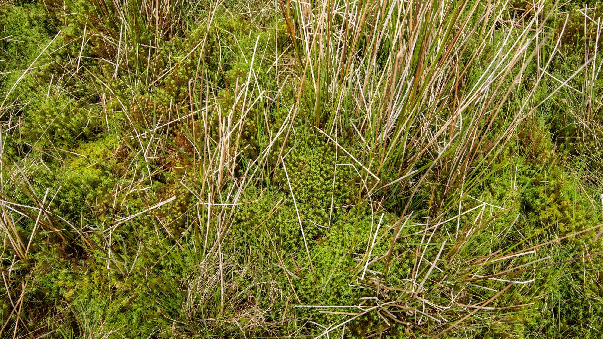
When we leave the stone circles and gain height, the land becomes very wet. Sphagnum mosses are like sponges, and there are star mosses, cotton grass and other plants I don’t know the name of. I look back across the pale grass bending in the wind, over the buildings of the farm lower down the valley, to patches of gorse full of bright yellow flowers, some greener hedged-in fields, and spreads of native woodland glowing emerald. Beyond all these are the chimneys of Sellafield. Who would know, standing in that most industrial of spaces, that up here the skylarks are dancing in the sky, and singing and singing and singing, or that rob and I follow a path towards Lank Rigg, and walk among herdwicks. There’s a group of sheep on our right marked with the Farthwaite smit mark, and those on our left are marked with the Side Farm smit. Hefted and happy in this windy place, they care little about the two of us, and know nothing of Sellafield.

Wind on the small tarn near the summit of Lank Rigg
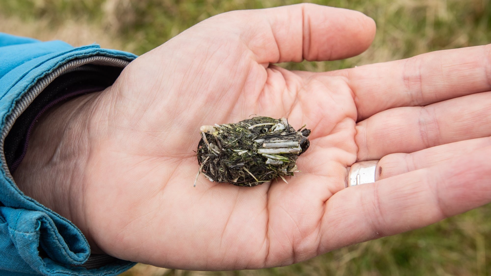
Just below the summit cairn of Lank Rigg, the cloud has come right down and the view is taken away. Rob is filming the patterns of water as the wind races across it and I look into the incredible world of mosses and fungi all around us. I find owl scat full of tiny bones and imagine the world of birds, the preying and the preyed, and the kind of silence that you’d hear up here if you were an owl, steadying yourself in the wind, your feathers rustling, the latest meal held in your talons.
On the top of Lank Rigg, the wind is deafening. But as soon as we lose height things feel calmer. A soft light eases through and again, I hear the skylarks. Down in the valley where Whoap Ghyll runs, wheatears dart between bushes, and there are cows chewing the cud - these will be the cows of Kevin Holliday, who we were with yesterday as he marked lambs on Side Farm. As we walk the land, we think back to the maps that were shared at a commoner’s meeting yesterday, showing an assessment different habitats and ecological qualities in this area. Treading the ground helps to place these broad representations in reality, and also reveals that things are far more complex than a map can show.

An old sheep wash on the edge of Whoap Beck
Being out here on the common is the necessary complement to talking to farmers and others who work here. If we are to learn more and begin to tease out the different elements of this complex place, being out here is the only way to get a bodily feeling for it. Here, we get a visceral sense of the way that one common can have many landscapes, how one common adjoins another, how unique each valley is, how sheep follow their hefts, and how open this land is among the Cumbrian fells. This is a kind of knowing that doesn’t come through interviews, but means that when we do listen to people who reference this place, what they say settles into our own visual and body-felt knowledge of the land. This builds up over time, as we spend more time in the uplands, and with more people whose lives are bound up with these spaces. Our own sense of place, gained from feeling and listening, helps us to join up the geography of places and people, to develop thoughts, and bring different perspectives into conversations.

Making notes to the sound of skylarks on the climb up to Lank Rigg
And as we bring our images and notes together, this will also feed into poetry, something that can capture experiences, and convey the intangible elements of this place, and settle somewhere between perspectives, times, and possibilities. As we finish our walk, and look back across the large loop we’ve covered in almost 13 miles, I squirrel away my notes to be stored with many others, ingredients for poetry that needs just a little more time to marinade before finding its full form.
Words: Harriet Fraser
Images: Rob Fraser

Looking east across the in bye land to Kinniside Common